Many-Headed Slime

Many-headed slime in search of food, mostly bacteria

Common Name: Many-headed slime, Grape cluster slime, Slime mold – The many branches that radiate outward from the site of initial growth form clusters at food sources consumed as sustenance. The overall appearance is one of many small nodes that are metaphorically compared to heads.

Scientific Name: Physarum polycephalum – The genus name is from the Greek physarion, meaning small bellows, which may refer to the characteristic pulsating growth which appears to surge as if wind-driven. The species name from Greek poly meaning many and kephalikos (Latin cephalicus) meaning head.[1] The translation literally means many-headed.

Potpourri: Slime molds were saddled with one of the most pejorative names in biology. The Animal Kingdom’s most despicable attribute of slime is sometimes applied to humans as the penultimate insult. The Fungi Kingdom’s worst form is mold, destroyer of agricultural crops and promoter of human respiratory disease. Even so, slime mold is an apt name in describing an unusual form of life. Slime molds bridge the gap between animals and fungi in transitioning from a mold-like spore that then germanites into an amoeba-like animalcule that moves like Lewis Carrol’s “slithy toves”.  The onerous task of organizing living things into a comprehensible structure has been a work in progress for centuries. With DNA replacing appearance as its organizing principle, phylogenetics has upended the historical hierarchical taxonomy of Carolinas Linnaeus. This transition is just beginning. Placing slime mold into its proper niche in the web of living things on the TBD list. For now, it is classified as a protist.

Numerous attempts have been made by intellectually curious, sapient humans to impose order on the entangled complexity of their surroundings. Schemes based on geographical locale, patterns of fruits and seeds, and gross morphology were all found to be impractical for field application. Linnaeus had the insightful idea of using sex as the organizational principal for plants, forming 26 categories based on the numbers and arrangement of the (all important) male stamens. Calling them vegetable letters he correlated stamen arrangements to the alphabet as a mnemonic. Praeludia Sponsaliorum Plantarum (Prelude to the Betrothal of Plants) was published in 1730, which garnered international interest that was both supportive and dismissive. Linnaeus forged ahead, and, based on the premise that “Minerals grow; Plants grow and live; Animals grow, live, and have feeling” settled on three kingdoms as his foundation. [2] The inclusion of inanimate rocks as an integral part of the tree of life is testimony to the ignorance of the times.

On December 13, 1735, the first edition of Linnaeus’s Systema Naturae (System of Nature) went on sale in Leyden, Netherlands with a section on the Mineral Kingdom and the Animal Kingdom to supplement the extant alphabetic Plant Kingdom. Minerals were dived into three categories named Petrae for simple stones, Minerae for simple stone mixtures, and Fossilia for aggregate rocky particles (that may or may not have an impression of an animal or plant); the system never made it into the work of Charles Lyell, who correctly classified sedimentary, metamorphic and igneous as the three types of rocks. [3] The Animal Kingdom was to have far reaching impact on the future of biology. Linnaeus devised the canonical format Kingdom, Class, Order, Genus, and Species to establish the first enduring method to catalogue living things into what became known as taxonomy.  He identified six classes of animals with 549 species: Quadrupeds (which included the Order Anthropomorpha and thus two-legged humans); Birds; Amphibians; Fish; Insects; and a final class as catchall named Vermes that included everything from reptiles to squid. A seventh group was tacked on at the end named Paradoxa for those animals that were missing from the rankings, as the semi-animal slime mold would have been.

Some twenty kilometers south of Leyden lay Delft, the home of Antonie van Leeuwenhoek, the unlikely father of microbiology.  As the owner of a fabric shop, the need for an improved method of magnification to inspect thread quality essential to the drapery business led him to the field of lens grinding, at which he excelled. In fabricating the first practical microscope, he was able to penetrate the heretofore unseen and unknown domain of the minuscule. An investigation of pond water yielded the presence of moving objects which he (correctly) interpreted to be animalcules. Over the course of the next century, as Leeuwenhoek’s hypothesis gained credence, the idea that these ubiquitous simple organisms must represent the origins of life gave rise to the term Protozoa, literally “fist life”. In the modern era, biology has yielded its operating system in the form of DNA coding for protein synthesis. Fungi were added to the kingdom count in the late 20th century (long after rocks had been expelled) but there were still outliers. This gave rise to Kingdom Protista, implying the same notion of first-ness for those living things that were neither animals, nor plants, nor fungi.  In addition to the slime molds, protists are inclusive of the animal/plant Euglenoids which are mobile photosynthesis factories, and brown algae aquatic Chrysophytes like kelp. [4]

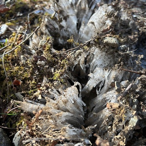
It is tempting to think of slime mold as an evolutionary alternative that was successful enough to survive but not sufficient for mutation and expansion to higher levels of organization. Slime molds have been referred to as Dr. Jeckel and Mr. Hyde due to similar extremes of form and behavior that a single individual might manifest. [5] The slime mold life cycle starts with a wind-blown spore that germinates under appropriate environmental conditions of temperature, water, and nutrients. Slime mold spores form one of two structures: a blob called a myxamoeba that can divide making multiple copies; or a body called a swarm cell that has a flagellum at one end for locomotion. The sexual union of two compatible myxamoebas or two compatible swarm cells yields a fertilized egg cell or zygote. Individual zygotes fuse into a multi-nucleus structure called a plasmodium that surges back and forth in search of food, the mysterious surging mass occasionally seen on woodland jaunts. When the food runs out or if conditions otherwise deteriorate, fruiting bodies are erected and new spores are ejected to comprise the next generation.[6] Thus, a slime mold can be considered as fungus, plant, or animal according to what stage is considered central. Like the ancient parable of the blind men and the elephant, which is like a snake if one first encounters the trunk but like a spear if one encounters the tusk, slime molds are different things to different people.

Scrambled egg slime, aptly named.

Slime molds have traditionally been categorized as myxomycetes from the Greek myxa meaning nasal slime and mykes meaning fungus, a name first applied in 1654. For the next 300 years, fungi were part of the Kingdom Plantae in the Phylum Thallophyta, a collective for primitive plants which also included lichens and algae. Even with sequestration of fungi as the separate kingdom Eumycota, slime molds were considered an integral member. Only recently were they relegated to Kingdom Protista. There are currently about 1,000 species of slime mold taxonomically categorized in 5 orders, 14 families, and 62 genera. [7] Fuligo septica is the best. known of the slime molds. Commonly called either scrambled egg or dog vomit slime (according to age and color) it often grows on garden mulch and can get quite large; a world record F. septica was recorded in Texas in 2016 that was 30 inches long and 22 inches wide. [8] Physarum polycephalum has recently gained the reputation as the slime mold of science due to its demonstrated ability to make what seem to be intelligent choices about the location of food sources and the best way to access them. This is of some interest to developing a better understanding the evolution of cooperation among individual organisms, such as that of social insects like ants and bees.

A scientific experiment conducted at Japan’s Hokkaido University in 2000 found that P. polycephalum was capable of determining the shortest path through a maze that connected two caches of oat flakes, a slime mold favorite.[9] The award of an Ig Nobel prize recognizing this unusual and thought-provoking experiment garnered international slime mold stardom.  Ten years later, researchers followed up on the maze trial with a map simulating Tokyo and its many train terminals marked by oat flakes. The objective was to determine if many-headed slime could find the best network route between them. The result, after only 26 hours of probing growth, was nearly identical to the extant Tokyo rail system, which presumably was the most efficient in practice and took decades to build. [10] The notion that slime molds could apparently make intelligent decisions led inevitably to media hype before settling down to the scientific underpinnings in recent years.

Slime mold replicating the train system of Tokyo (Reference 10)

 The New York Times proclaimed the wisdom of slime in 2012, noting that it behaved as though it were “extremely intelligent” in creating networks that optimized the transport of nutrients. To promote interest for an American audience, a map of the United States was created with oat flakes marking 20 urban centers with slime mold propagating outward from the simulated location of New York City. The resultant connections nearly replicated the interstate highway system in four separate trials. [11] Broadcast media followed up this somewhat scientific finding with a report that slime mold could “solve problems even though it doesn’t have a brain” and had 720 sexes instead of only the boring two. [12] (Since slime molds don’t have bathrooms or sports teams, their social issues should be manageable). Research on the mechanisms employed by slime molds to locate and exploit food along the most favorable paths continues. The physical process is thought to be similar to the movement of fluids in the intestines, known as peristalsis, with slime mold tubes containing cytoplasmic fluid that surges and retracts in reaction to food quantity and quality. [13] From the perspective of a neurologist, the selection process is called emergence and is similar to the scouting methods used by ants to locate the best nesting site and bees to locate the best food source. In the case of slime molds, tubes are sent in all directions as “scouts” and retracting the unsuccessful paths to flow fully in the food direction. [14] An experiment to evaluate slime mold food preferences is not unlikely.

References:

1. Webster’s Third New International Dictionary of the English Language Unabridged, G. & C. Merriam Company, Philippines, 1971.

2. Roberts, J. Every Living Thing, Random House, New York 2024, pp 45-95.

3. Cazeau, C, Hatcher, R. and Siemankowski, F. Physical Geology, Principles, Processes and Problems, Harper and Row New York 1976, pp 6-11.

4. Starr. C. and Taggart, R. Biology, Wadsworth Publishing Company, Belmont, California, 1989, pp 62, 600-609.

5.Lincoff, G. The Audubon Field Guide to North American Mushrooms, Alfred A. Knopf, New York, 1981, pp 843-854.     

6. Kendrick, B. The Fifth Kingdom, Focus Publishing, Newburyport, Massachusetts, 2000. P 10.

7. Keller, H. Everhart, S. and Kilgore, C.  “The Myxomycetes: Nature’s Quick-Chage Artists” American Scientist, Volume 112, September-October 2024 pp 352-359.

8. Keller, H, “World Record Myxomycete Fuligo septica Fruiting Body (Aethalium)” Fungi Volume 9 Number 2, September 2016 pp 6-11.

9. Nakagaki, T. et al. “Intelligence: Maze-solving by an amoeboid organism”. Nature. 28 September 2000 Volume 407 Number 6803 page 470.

10. Wogan T. “Ride the Slime Mold Express” Science 21 January 2010.

11. Adamatzky, A and Ilachinski, A, “The Wisdom of Slime” New York Times, 12 May 2012.

12. Zaugg J. “The ‘blob’: Paris zoo unveils unusual organism which can heal itself and has 720 sexes”. CNN. 17 October 2019.

13. Alim, K et al. “Random network peristalsis in Physarum polycephalum organizes fluid flows across an individual”. Proceedings of the National Academy of Science USA. 29 July 2013 Volume 110 Number 33. pp 13306–11.

14. Sapolsky, R. Determined, A Science of Life without Free Will, Penguin Press, New York, 2023, pp 154-166.

Needle Ice

Needle ice extends upward into the frigid air at night at the rate of about a centimeter a day.

Common Name: Needle Ice, Ice flowers, Frost flowers, Ice fringes, Ice filaments, Rabbit ice, Ice castles, Ice leaf – The various descriptive terms are applied to an ice formation depending on the configuration of its components that can range from narrow needles to blocky castles.

Scientific Name: Segregated Periglacial Ice – Characterized by an area that is subject to intense freeze-thaw conditions (periglacial) that extends (segregates) from a frozen substrate, which may be ground soil or a plant stem. The name Crystallofolia has been proposed as a Latinized version of ice flower.

Potpourri: Hiking in winter is a challenge as air temperature often drops below the freezing point of water. Water is wet and sometimes slick but ice is slipperier and potentially dangerous. Mountainous regions are particularly susceptible to icy conditions for two reasons. The first is that ground water accumulates in the high volume terrain much more than level areas. It is drawn by gravity downslope, forming rivulets in ravines that combine to become the headwaters of rivers flowing eventually to the sea. Freezing is also a matter of height since temperature decreases between 3 and 5 degrees Fahrenheit (depending on how dry the air is) with every 1000 feet of elevation gain (6-10 degrees Celsius per kilometer). Sometimes physics is not intuitive. Lower temperatures occur when hiking upward in elevation because there is less atmosphere above and therefore less pressure, making  the molecules of air (mostly nitrogen and oxygen) move further apart. Temperature is a measure of molecular movement which is therefore lower when going higher. More elevation, more ice.  Because of this effect, a gently meandering downward trail can turn into an icy toboggan run without a sled. Ice can be beautiful just as it is oftentimes treacherous. Under certain conditions, it forms ice sculptures with variety of shapes and sizes. The most common form is needle ice.

The formation of needle ice structures is a well-recognized phenomenon in areas with the necessary and sufficient environmental conditions; it is called kammeis in Germany, pipkrake in Sweden and shimobashira in Japan. The German name kammeis translates to “comb ice” as the structure suggests the teeth of a hair comb. It occurs on sloped regions to the extent that a special name, kammeissolifluktion, is given to the process of movement of soil down the face of a slope due to comb ice. The Swedish name pipkrake is used largely in reference to sub-arctic needle ice. Pipkrake formation results in frost creep,  one of the primary geomorphologic processes associated with the shift of temperature across the freezing point of water. Frost creep occurs in permafrost regions due to the action of the individual pipkraken (needles) that rise beneath individual sediment particles. The net movement of soil due to needle ice/pipkrake is up to one meter per year; laboratory demonstrations have shown that pipkrake can lift ten pound rocks. The Japanese word for needle ice, shimobashira, translates as “columns of frost.”

Needle ice can be defined as “the accumulation of ice crystal growths in the direction of heat loss at, or directly beneath, the ground surface.” There are some complexities in this definition that relate to thermodynamics, the branch of physics that deals with the relationship between heat and energy.  [1] However, the mechanism of extending ice can be understood from observing the conditions under which it occurs. The fundamental requirement is a diurnal freeze-thaw cycle, which is nothing more than a 24 hour period during which freezing occurs at night followed by thawing with the radiant heat of the sun starting a dawn’s early light. In mountains, the area where this will occur depends on the height above ground due to the effect of elevation on temperature and the degree to which the sun is shaded by adjacent slopes. [2] Soil composition is also important in channeling the extending ice crystals in parallel columns. Soil is classified according to the relative amounts of three basic forms/sizes that arise depending on the degree of the erosion of weathered rocks. The largest particles are sand ranging in diameter from 0.05 mm to 2 mm. Silt is smaller, starting at 0.01mm. Clay particles are one order of magnitude lower, in the micron range, imparting a slippery feel to soil. A soil that has an even mix of sand, silt, and clay is called loam. Needle ice is most prevalent in soils that are made up of small sand particles with about 10 percent silt or clay. [3] It may be concluded that needle ice forms in columns separated by soil particles as water is pushed upward into the frozen air.

The thermodynamics of water is the essence of meteorology and oceanography (and therefore weather and climate) at the macro scale  just as it is of needle ice at the micro scale. Radiant heat from the sun in the form of photons is the font of all energy. Plants use sunlight energy to produce hydrocarbons and exhale oxygen. Oxidation of hydrocarbons in the mitochondria of all cells is the energy of growth and movement. With a higher intensity along equatorial latitudes, the sun’s radiant photons interact with either solid ground, causing concrete hot spots in cities, or water, mostly ocean, causing evaporation. Water molecules thus vaporized rise from the oceans and cool as they travel skywards to condense as clouds. The energy of evaporation, called the latent heat of evaporation, is returned when water vapor becomes liquid, falling as rain, snow, and sleet. This returned energy is what powers the weather, manifest in the extremes with thunderbolts of lightning and tornado whirlwinds. The rotation of the earth swirls the rising tropical vaporous clouds as they move away from the equator toward the poles to create weather. At the other end of the temperature spectrum is the latent heat of fusion, that amount of energy needed to melt solid ice to yield liquid water. Since it takes energy to melt ice, then energy must be released when ice forms. This is what is meant by the definitive statement that needle ice grows in the direction of heat loss. Energy from liquid water freezing is what forms the vertical needle column and moves it upward. [4]

Each water molecule is attracted to four adjacent water molecules with hydrogen or polar bonds.

The growth of needle ice is also affected by an increase in volume that occurs when liquid water solidifies. Solid water ice is 9 percent larger in volume that the liquid water from which it arose. This very unusual behavior for a substance occurs due to the nature of the bonding between the two hydrogen atoms and one oxygen atom that make up the water molecule, the familiar H2O.  The water molecular attractive bond called a hydrogen bond acts between two molecules that results from polarity, the familiar positive (+)  or negative (-)  of electric battery terminals. Hydrogen bond sites occur due to the way water molecules are put together.  Chemical compounds between atoms occur by sharing electrons so as to achieve a stable number of electrons which is the same as those in the inert gases at the far right side of the periodic table, which don’t react with anything (inert is the adjective form of inertia, to remain at rest). Oxygen needs two extra electrons which it shares with two hydrogens each with a single electron. Oxygen bonded to hydrogen in water is like the inert gas neon in stability. The result of the covalent water bonds is the creation of a positive charge on region on the hydrogen atom side of the water molecule  and a  negative charge on the oxygen atom side. These are called dipoles due to having two poles, one positive and one negative. The hydrogen or dipole to dipole bond occurs because opposite charges attract each other with an electrostatic force. Each water molecule is hydrogen bonded to four adjacent water molecules. [5]    

The weak electrostatic attraction of hydrogen bonds is what makes water fluid. It is also what makes liquid water more dense than frozen water. The freedom of liquid hydrogen bonds to attach to alternative and closer molecules draws them more tightly together. When crystallized as ice, molecules are rigidly set in space further apart, which is why ice occupies a larger volume than the liquid it formed from. Since ice is less dense than water, icebergs float and ponds freeze from the top down and not the bottom up.  This fact is enormously important to life on earth. If ice sank, the oceans would fill with ice and only a thin surface layer would be melted by the sun. Earth would essentially be an ice-covered ball. Further, since life (apparently) arose in aqueous (watery) saline (salty) conditions that we call oceans, there would almost certainly be no life on a frozen earth. When organisms eventually ventured out of the oceans onto dry land, they could continue to operate only by taking the ocean with them. Which is why humans and all other mammals are about 60 percent salt water. The hydrogen bond of water molecules in an aqueous environment is what makes life work. “The structures of the molecules on which life is based, proteins, nucleic acids, lipid membranes, and complex carbohydrates result directly from their interactions with their aqueous environment The combination of solvent properties responsible for the intramolecular and intermolecular associations of these substances is peculiar to water (italics in original).” [6]  Something to think about when you look down at the needle ice on the trail.  

Needle ice causes damage to plants by pushing up the soil around the roots.

Aside from aesthetics, needle ice formation is of scientific interest due to plant damage that is often its result. In order to establish the key variables in the formation and growth of needle ice, a montane area near Vancouver, British Columbia was instrumented and monitored in the late 1960’s. Weather conditions consisted of a prolonged anticyclonic period with clear, cold, and dry air. An anticyclone is the clockwise  (CW) circulation (in the northern hemisphere) of air around an area of high (H) pressure noted for cloudless blue brilliance. Cyclones are the opposite, turning counter-clockwise (CCW) around low (L) pressure areas which, under extreme conditions, result in hurricanes. Over the course of eleven sequential 24-hour noon to noon periods, parametric data were collected to evaluate the effects of temperature and time on needle formation and mean values calculated from the eleven data sets. Starting with the nucleation of ice at the bottom of the needle that started 9.9 hours after noon (about 2200), the nominal ice needle grew for 7.3 hours with an elongation of 9 millimeters (about 1 centimeter or 1/3 inch). As the sun rose the next day, the maximum surface temperature reached 12.8 °C (55 °F) at about 1330, resulting in some melting, and, more importantly, evaporation of the soil water into the desiccated air. Depending on the balance between freezing at night and melting during the day, needle ice formation is either homogenous (top photo), with continuous upward growth, or heterogeneous (right photo), with repetitive cycles of soil upheaval and subsidence, the latter resulting in greater damage. [7]

Ice flowers result from longitudinal splits on the stem of some plants.

The formation of ice structures that resemble flowers or ribbons is due to a freezing phenomenon that is closely related to that which causes needle ice. The fundamental difference is that ice flowers exude from the stems of certain plants whereas needle ice exudes from ground water without any botanical conduit. The geometry of certain plants and rotting wood is such that a passage for supercooled water is created. When the temperature drops, longitudinal cracks form along the axis of the stem and allow the liquid to ooze out into sub-zero air to be almost instantaneously frozen into a ribbon-like crispation. The overpressure that pushes the extruded ribbon out is thought to be the result of the gradual freezing of the water in the stem.[8] Ice flower formation is often erroneously attributed to frozen sap, which may contribute to the cracking of the stem wall.  However, there is not enough sap in the plant to create the “remarkable accumulations of voluminous friable masses of semi-pellucid ice around the footstalks of the Pluchea (fleabane) which grow along the road-side ditches”  as described by Dr LeConte of the University of Georgia in 1850. The plants that exhibit ice flower formation have been identified by observation, as the relevant dimensions of the plants’ structures that result in the phenomenon have not yet been determined. The list, largely anecdotal includes: dittany (Cunila origanoides), frostweed (Helianthemum canadense), yellow ironweed (Verbesina alternifolia) and white crownbeard (Verbesina virginica). [9]

Ice portal on AT in Shenandoah National Park near Matthews Arm

Spring is for flowers, summer is for fauna, fall is for fruit and fungi. Winter is for ice. Solid water frozen into structures sculpted by the physical properties of soil and air are quest-worthy. While ice needles may be admired for incongruous symmetry and ice flowers marveled for their mobius strip curvature, wind and water in frigid air works equal wonder. The trinity of water as vapor, liquid, and ice is as profound and deeply rooted in relevance to humans as the spiritual trinity that guides the lives of many. Cathedral portals through the iced boughs and branches offer solitude and purpose just as those of churches. Here one may find  the animist gods of the aborigine, the lares and penates of the wooded home, and the solitude of the soul, reduced to the raw elements that are ultimately its origin.

References:

1. Grab, S. “Needle-Ice”. In Goudie, Andrew (ed.). Encyclopedia of Geomorphology. Routledge. p. 709.

2. Pidwirny, M.: Fundamentals of Physical Geography, 2nd ed., section 10(ag), Periglacial Processes and Landforms

3. Nardi, J. Life in the Soil, University of Chicago Press, Chicago, 2007, pp 1-6.

4. Petrucci, R. General Chemistry, 4th Edition, Macmillan Publishing Company, New York, 1985, pp 140-151, 285-298.

5. Ibid. pp 305-307.

6. Voet, D. and Voet, J. Biochemistry, John Wiley and Sons, New York, 1990, pp 29-34.

7. Outcalt, S. “A Study of Time Dependence During Serial Needle Ice Events” Department of Environmental Sciences  University of Virginia, Charlottesville, Virginia, U. S. A. 23 April 1970. Water Resources Journal , Volume 7,  pp 394-400.

8. Carter, J. “Flowers and Ribbons of Ice” American Scientist. Sep-Oct 2013, Volume 101, Number 5. p. 360.

9. Carter, J.  “Needle Ice” Geography-Geology Department Illinois State University, Normal IL https://www.jrcarter.net/ice/needle/

Catoctin Formation

After about 600 million years, the Catoctin Formation still looks like lava.

Catoctin Formation:  A catoctin is defined as “a residual hill or ridge that rises above a peneplain and preserves on its summit a remnant of an older peneplain,” where peneplain is “an erosion area of considerable area and slight relief.” [1] It is derived from Catoctin Mountain in north-central Maryland where the Catoctin Formation was first noted as consisting of a geologic plain rising above a plain. Some sources contend that a tribe of Native Americans called Kittocton were resident in the general area and if that is the case, it is almost certain that Catoctin is a toponym. [2] However, the existence of a tribe named Kittocton is probably specious as the tribe is not listed by the National Geographic Society. [3] Many geographical names came into common parlance without any records―ancient wooded hill, land of many deer and speckled mountain have also been proffered as the meaning of Catoctin in one of now lost Native American languages.  

Potpourri: The Catoctin Formation is the most recognizable geological feature of the Blue Ridge Province of the Appalachian Mountains. Its origin as lava that flowed out of fissures in the earth’s crust is evident in the sequential cascades that solidified as they spread over the pre-Cambrian landscape about 600 million years ago (mya). Even though it was named for Catoctin Mountain, where it can only be seen in a relatively few and out of the way places, it is the capstone rock assemblage in Shenandoah National Park. The Marshall Mountains dominate the northern section of the park, benches of lava flowing outward to form the roadbed for Skyline Drive.  White Oak Canyon, a cynosure of the central section follows the circuitous lava flow path. The Appalachian Mountains are over a billion years old. In contrast, the 60-million-year-old Rocky Mountains and even younger Himalayas are relative newcomers to terra firma. The Catoctin Formation is the keystone that connects the arc of the ancient past to the ever-evolving present. [4] How could magma from earth’s liquid mantle flow through and then out over the crust in a place that is now as placid and peaceful as a national park in western Virginia?  

Plate tectonics emerged as a coherent and scientifically supported theory of geology in the middle of the last century. It was first postulated by the German meteorologist Alfred Wegener in 1915 based on the conformity of the contours of the western coastline of Africa and the eastern coastline of South America. Supporting observations of geologic and fossil similarities that straddled not only South America and Africa, but also Australia and India could only be explained if these areas had at one point been connected in a single land mass, eventually named Gondwanaland for a region in India. The idea that massive continent-sized chunks could somehow move around, floating on top of a pool of molten rock agitated by planetary rotation and lunar gravity, and plow through oceanic crust like an ice breaker seemed too fanciful to many geologists until the middle of the century when further research revealed a viable mechanism. Sea floor spreading was confirmed by the observance of magnetic field shifts in solidifying magma flows in the mid-ocean ridges to provide a source of new crust. That earthquakes recurred in known prone zones led to the notion that plate movement was involved. The term subduction was given to the sliding of great arcs of oceanic crust under adjacent and less dense regions of crust to be remelted as magma in the mantle. With a supply of new magma emerging from the ridges and a recycling facility for old magma in subduction, there was no need to plow through anything. [5] So what has all this got to do with the Catoctin Formation?

The tectonic plates, many with lower density sections that are the land mass continents contained within their boundaries, have been floating around driven by the chaotic forces of physics by the liquid mantle for most of Earth’s 4.5-billion-year history. When two plates with the less dense continental crust float into each other, subduction is not an option and a headlong crash results. When an irresistible force meets an immovable object, something has to give and the only option is skyward. The result is an orogeny, from the Greek oros, meaning mountain. The mountain building orogeny that created the original Appalachian Mountains about 1.2 billion years ago is named Grenville for a small town in Quebec on the Canadian Shield central core of the North American plate. Wegener’s preliminary hypothesis that there was a contiguous area he called Gondwanaland was later expanded to include a second northern land mass named Laurasia that joined to form the supercontinent Pangaea (Greek for all earth) about 300 mya. Over the last several decades, additional geological analysis of bedrock on a global scale has concluded that the movement of plates results in the reassembly of at least 75 percent of all the jigsaw puzzle of landforms into a supercontinent roughly every 750 million years. Pangaea was proceeded by Rodinia, a name derived from the Russian word rodit meaning to give birth as it was at first thought that Rodinia was the original supercontinent that gave birth to all others. Further research has posited an additional supercontinent named Columbia that precedes Rodinia with evidence of additional combinations that extend as far back as the Proterozoic Eon that started 2.5 billion years ago. [6]

Catoctin Formation dike through older bedrock

The bedrock of the Appalachian Mountains was then the result of the collision of the land mass containing North America named Laurentia with the land mass containing northwestern Eurasia named Baltica that gave rise to what was to become Laurasia (North America and Eurasia) about 1.2 billion years ago. When Rodinia started to break apart about 700 mya, fissures opened, allowing magma in the form of lava to flow upward out of the mantle, through the bedrock of the Grenville orogeny, and spread out over its surface. This is the fons et origio of the Catoctin Formation.  Continued expansion in a manner similar to the opening of the eponymous Atlantic Ocean in the present geologic age resulted in its precursor named Iapetus, the father of Atlas in Greek Mythology. Initially, the cooled magma was covered by rough gravel at the shallow waters edge as the mountains were worn away by erosion. As the ocean expanded, the now submerged Appalachian bedrock with its lava coating became covered by smaller sized particles, and eventually the fine silted sand of mid ocean. The gradation of sediments of stone to pebble to sand on top of the Catoctin Formation is evident in the present day Weverton, Harper’s, and Antietam formations that make up the Chilhowee Group. [7] Iapetus stopped opening and began to close about 400 mya, creating Pangaea from Laurasia and Gondwanaland with a series of three orogenies named Taconic, Acadian, and finally Alleghany as the various plates collided from north to south. The resultant Appalachian Mountains were probably as high or higher than the Rockies at their peak uplift. Pangaea’s disassembly started near the end of the Mesozoic Era about 65 mya and is still in progress, the once buried lava rocks of the Catoctin Formation now in full view after millennia of erosion of the once majestic mountains to create the coastal plane. [8]

Geology as the science dealing with the physical nature and history of the earth has evolved extensively through the ages; even the rather obvious origins of lava have been misunderstood. While the Greeks and Romans appreciated the nature of lava and eruptions (the burial of Pompeii by the eruption of Vesuvius in 79 CE could hardly have been misinterpreted), the ensuing Dark Ages of biblical doctrine stifled the study of nature. According to Archbishop James Ussher of Ireland, the earth was created on Sunday, 23 October, 4004 years Before Christ and Noah’s flood was responsible for all current landforms. Even when science rebounded after the Renaissance, geology was especially difficult since it is mostly out of sight in tangled knots of rocky confusion. The noted German geologist Abraham Werner conceived that a universal ocean originally covered the earth and that all rock precipitated from it, dismissing the volcanic origins of lava altogether. His adherents, which included most geologists in the eighteenth century, were called Neptunists for the Roman God of the Oceans Neptune. The Vulcanists named for the Roman god of fire and the hearth, restored lava to its true provenance as magma emerging from fiery mantle. The word lava came into wide use in the 17th century from the Italian dialect around Naples, Italy (near Vesuvius) and meant something like falling― presumably from Vulcan’s home which had become a volcano.  Lava, in current parlance that reflects decades of study, comes in three basic forms: A’a for rough, fragmented blocks; Pahoehoe for smooth, undulating flows; Pillow for lava that emerges under water. A’a and pahoehoe are of Hawaiian origin due to the importance of the perennial lava flows that were key to early studies in volcanology. The lava of the Catoctin Formation is primarily dry, flowing, pahoehoe.

The primary constituent of the Catoctin Formation is basalt (from the Greek basanites, a type of slate used to test gold from basanos meaning test).  Basalt is an igneous (ignis is Latin for fire) rock, the generic name for any rock created directly from magma, the liquid rock of the mantle. Because of the low silica content, basalt has a low viscosity, so that the lava flow can move relatively quickly and travel as far as 20 kilometers from the source, which can be either a single vent or a long fissure.  Basalt is erupted at temperatures that range from about 2000 to 2100 °F, to become either a’a or pahoehoe depending on temperature and topography.  Basalt is the most abundant igneous rock in the earth’s crust, comprising almost all of the ocean floor. A rock is defined by the combination of minerals that it contains. A mineral is “a natural substance, generally inorganic, with a characteristic internal arrangement of atoms and a chemical composition and physical properties that are either fixed or that vary within a definite range.” [9] The primary minerals that make up the rock basalt are pyroxene and feldspar.

Pyroxene is from the Greek pyr and xeno meaning “alien to fire.” The pyroxene of Catoctin Formation basalt is a complex of different minerals that are silicates of magnesium and calcium and which include iron and manganese.  The general formula is X(Si,Al)2O6 where Xcanbe calcium, sodium, iron, or magnesium.  Magma that contains significant amounts of magnesium (Mg) and iron (Fe) is called mafic as an acronym for these elements. The other major component of magma consists primarily of feldspar and silica; it is called felsic according to the same logic. Feldspar, the other major constituent of Catoctin Formation basalt, is a complex of aluminum silicate minerals, i.e. containing aluminum and silica, in combined with potassium (KAlSi3O8), sodium (NaAlSi3O8) or calcium (CaAlSi2O8). Feldspar is derived from feldspat, German for “field flake” referring  to common rocks typically strewn about an open area that could readily be cleaved into flakes.  Feldspar comprises over fifty percent of the earth’s crust. The similarity between basalt and feldspar in terms of elemental composition is due to the dominance of oxygen in chemical combinations. The earth’s crust is about 50 percent oxygen combined with 30 percent silicon, 8 percent aluminum with iron, calcium, sodium, potassium and magnesium making up most of the balance at 2 to 5 percent each. [10]

The basaltic lava flows that first emerged from the mantle during the breakup of Rodinia have been subject to 600 million years of change. This included some millions of years under the Iapetus Sea and the crushing pressures of the assemblage of Pangea. The effects of the pressures and temperatures of deep depths and orogenies on existing rocks changes their shape, structure and properties. The name for the resultant rocks is metamorphic, literally changed body. To provide an overarching order to the otherwise intricate complexities of the mineral combinations of individual rocks, they are subdivided into three general types. Igneous rocks of the magma were first, solidifying in the first days of the nascent Earth’s cooling. Water evaporated from the primordial oceans precipitated as rain over lava lands, causing the erosion to transport grain by grain into the ocean to form sediments that gradually sank under their own weight to form sedimentary rocks. As the physics of balancing forces formed separated plates that drifted in their own magma ocean, the resulting colossal forces changed or metamorphosed the igneous and sedimentary rocks. Sedimentary shale became slate and igneous basalt became metabasalt. The Catoctin Formation that remains is the result of an unimaginable journey that took it from the peak of the tallest mountains to the deep sea and back again. While it still retains its basic lava-like appearance in places, it is comingled with many other rock types with their own histories. It has equally been subjected to differing environs that changed its core composition.

Catoctin Formation bounded by metabolized sandstones.

The Catoctin Formation has the colloquial name greenstone due to the gray-green coloration of many outcroppings, a result of its metamorphic journey. The Catoctin basalt is comprised of phenocrysts (large crystals) of plagioclase feldspar named albite in a fine-grained matrix of the minerals chlorite, magnetite, actinolite, pyroxene and epidote.   Epidote is a structurally complex mineral of calcium, aluminum, iron and silicon [Ca2 (Al, Fe) 3(SiO4)3(OH)] that has a green color described as pistachio.  It is this mineral that, when present, gives the Catoctin Formation a distinctive greenish hue. The sequential lava flows over an extended period are reflected in the diversity of the Catoctin Formation. The boundaries between the lava flows are marked by breccias, metatuffs, and metasandstone.  Breccia is a rock comprised of smaller rock fragments cemented together by sand, clay and/or lime.  These rocks identify areas where a crust formed on a lava flow that was disrupted by subsequent flows.  A tuff is a porous rock created by a consolidation of volcanic ash.  The metabolized tuffs, or metatuffs, are attributed to a rapidly moving cloud of molten ash.  The metabolized sandstones, or metasandstones, mark the boundary between one lava flow, a period of erosion and sedimentation, and a second lava flow. [11]

References:

1. Webster’s Third New International Dictionary of the English Language, C. G. Merriam Co.  Encyclopedia Brittanica, Inc, Chicago, 1971 p 354, 1669.

2. http://www.npshistory.com/publications/cato/index.htm   

3. “Indians of North America” National Geographic, Volume 142, Number 6, December 1972

4.Gathright, T., Geology of the Shenandoah National Park, Virginia Department of Mineral Resources Bulletin 86, Charlottesville, Virginia, 1976, pp 19-25.

5. Cazeau, C., Hatcher, R., and Siemankowski, F. Physical Geology Harper and Row Publishers, New York, 1976, pp 374-393.

6. Meert, J. “What’s in a name? The Columbia (Paleopangaea/Nuna) supercontinent”. Gondwana Research. 14 December 2011, Volume  21 Number 4 pp 987–993.    https://www.gondwanaresearch.com/hp/name.pdf   

7. James Madison University Geology Notes –  https://csmgeo.csm.jmu.edu/geollab/vageol/

8. Schnidt, M. Maryland’s Geology, Shiffer Publishing, Arglen, Pennsylvania, 2010, pp 88-112.

9. Dietrich, R. Geology and Virginia, The University Press of Virginia, Charlottesville, Virginia, 1970, p 4.

10. Cazeau et al op cit.

11. USGS Geological Survey Bulletin 1265 “Ancient Lavas in Shenandoah National Park Near Luray, Virginia” https://www.nps.gov/parkhistory/online_books/geology/publications/bul/1265/sec2.htm